Corsica · Calenzana to Conca
GR20
Corsica’s granite spine, and Europe’s hardest waymarked trek
At a glance
- Distance
- 180 km
- Duration
- 13–16 days
- Elevation gain
- 12,500 m
- Highest point
- 2,225 m
- Difficulty
- Expert
- Countries
- France
- Best season
- Mid-June to late September
- Waymarking
- Good
- Water points
- Moderate
- Luggage transfer
- Not available
- Accommodation
- Refuges, Campsites
- Permits & bookings
- Not required
Before or after the walk
Tours and visits in Ajaccio · Calvi
A few well-rated options near GR20, for the rest days either side of the trail. Prices are the provider’s current starting price.
Affiliate links: if you book through them we may earn a commission, at no extra cost to you. It never changes our stage, distance or luggage information. (Civitatis) How the project is funded
The route
The GR20 crosses Corsica along its granite watershed, 180 km from Calenzana in the hills above Calvi to Conca, inland from Porto-Vecchio. It divides at Vizzavona into a rugged northern half and a gentler southern half. Waymarking is the standard French red-and-white GR flash, generally clear but sometimes painted on bare rock where the line of the path is not obvious. It has a reputation as the toughest waymarked long-distance route in Europe, and the numbers support it.
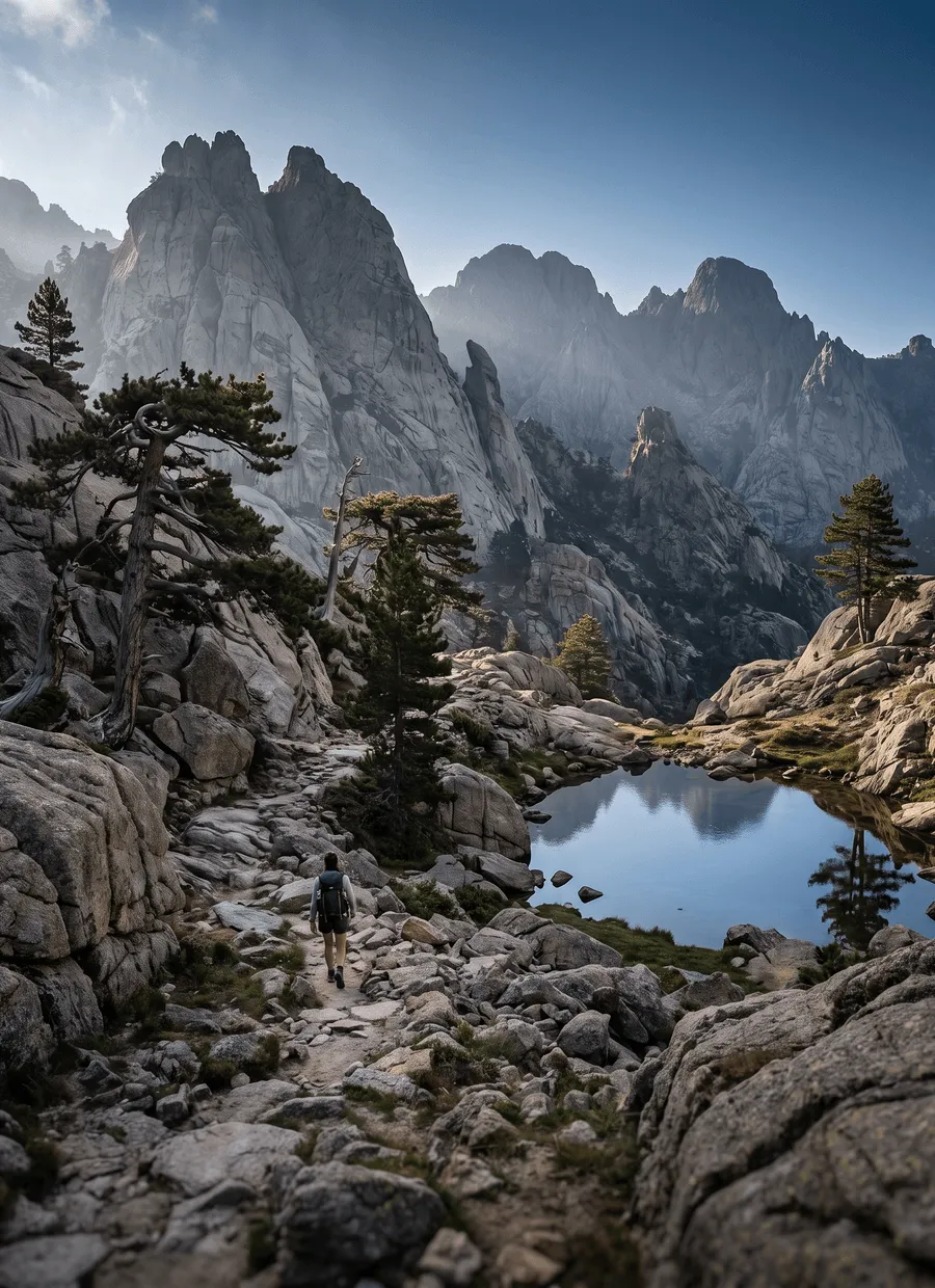
Roughly 12,500 m of ascent packed into 180 km is the reason. The route rarely traverses; it climbs to a col, drops to a bergerie, then climbs again. The highest point is the Brèche de Capitellu at 2,225 m. Much of the surface is bare granite slab, boulder field and loose stone, and you will use your hands on the northern half almost daily. Chains and short cabled steps appear in a few places, and the old Cirque de la Solitude has been replaced by a variant over the Pointe des Éboulements since the 2015 rockfall.
Fifteen days is the standard schedule, thirteen a hard one, sixteen comfortable. Averages of 12 km a day sound trivial and take six to eight hours: Refuge de Carrozzu to Haut Asco is only 6 km and eats a morning, Calenzana to Refuge d’Ortu di u Piobbu is 12 km with about 1,500 m of climb, and the final Bavella to Conca stage is 19 km. Many walkers do only the northern half, Calenzana to Vizzavona in eight or nine days, which is the classic short version.
The walking season is mid-June to late September. Snow lies in the north-facing couloirs until late June, and early-season crossings of the higher cols can need care. July and August bring stable weather, packed refuges and real heat on the lower stages, along with afternoon storms that build over the ridge. September is quieter and cooler, but water sources are at their lowest and refuge services start to wind down towards the end of the month.
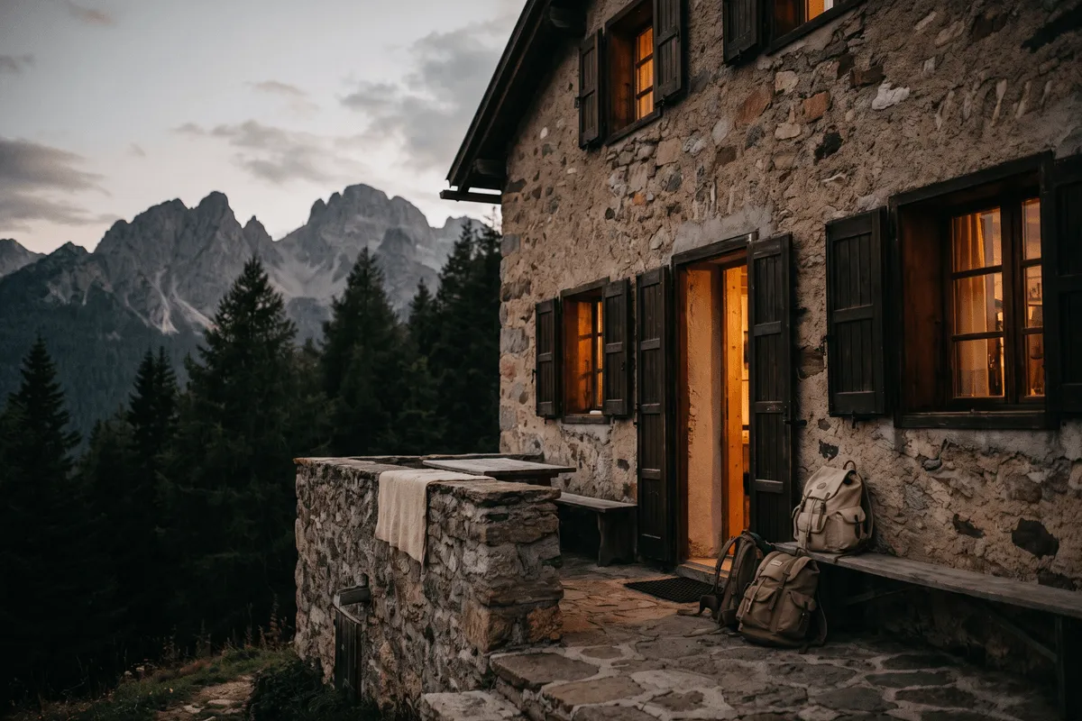
Nights are spent in the refuges of the Parc naturel régional de Corse, either in a bunk room or in a tent pitched on the refuge platform. Beds are booked through the park system and, in July and August, sell out well ahead. Some refuges provide meals, some sell only basic supplies, and the shepherds’ bergeries along the way serve food and cheese, often cash only. There are no hotels on the route itself apart from Haut Asco, Vizzavona and Bavella.
This is a route for experienced mountain walkers who are steady on rock, comfortable with exposure and used to carrying a heavy pack for two weeks. It is a bad first long-distance trail. It is also unsuitable for anyone who needs bag transfer, a guaranteed private room or a reliable escape route mid-stage, since road access appears only every few days. Walkers who want Corsican mountains without the scrambling usually take the Mare a Mare or Mare e Monti routes instead, which cross the island at lower altitude.
Sample stages
A representative breakdown, not a prescription — most walkers adjust daily distances to their pace, rest days and the weather.
- Day 1 Calenzana → Refuge d’Ortu di u Piobbu 12 km
- Day 2 Refuge de Carrozzu → Haut Asco 6 km
- Day 3 Haut Asco → Bergeries de Ballone 9 km
- Day 4 Vizzavona → Bergeries d’E Capanelle 14 km
- Day 5 Bavella → Conca 19 km
- Sample total 60 km
Practical notes
The things that change how a walk actually goes.
The northern half involves regular use of hands on granite slab and boulder, with short chained steps. Wet rock is genuinely slippery. Grippy soles, a pack that does not pull you backwards and a head for exposure matter more than speed.
Springs at refuges and bergeries are the reliable sources, and mountain streams shrink through the summer until some disappear by late August. Carry two to three litres on long stages, and ask each refuge guardian which sources are still running ahead.
No permit is needed to walk, but overnight places in the Parc naturel régional de Corse refuges are reserved and paid in advance through the park system, and July and August fill early. Tent pitches on refuge platforms are the fallback, and cannot be assumed.
August combines full refuges with high temperatures on the lower stages and afternoon thunderstorms over the ridges. Starting before six, finishing by early afternoon and treating a warm, still morning as a warning sign is standard practice here.
Resupply exists only where a road reaches the trail: Haut Asco, Castel di Vergio, Vizzavona, Capanelle and Bavella. Between them you carry several days of food, which is why packs on the GR20 are heavier than on any comparable Alpine route.
Getting there & back
Calvi is the closest airport to the northern trailhead, about 20 km from Calenzana, with a taxi taking half an hour and a seasonal shuttle running for walkers. Bastia airport and the ferry ports at Bastia, Calvi, Ajaccio and Île-Rousse are the alternatives, with crossings from Nice, Marseille, Toulon, Livorno and Savona. Most walkers reach Calenzana the evening before and sleep at the village gîte in order to start at dawn.
Conca is a small village with no railway. A local shuttle links it to Sainte-Lucie-de-Porto-Vecchio on the coast road, from where buses run to Porto-Vecchio and on to Figari and Bastia airports. Allow a buffer day, because island bus frequencies are modest and ferry sailings are seasonal. Walkers finishing the northern half at Vizzavona have it easier: the station sits on the Ajaccio to Bastia line.
Luggage transfer on this route
Bag transfer is not available on the GR20, because the refuges are reached only on foot. You carry everything, including several days of food, a sleeping bag, since bedding is not provided, and often a tent. A few road-accessible points, Haut Asco, Castel di Vergio, Vizzavona, Capanelle and Bavella, allow a supply drop or left luggage, which is the closest thing to support on this route.
Luggage transfer on long-distance trailsOfficial sources & maps
Go straight to the primary sources. We link out rather than re-publish, because these are the pages that stay current.
External links open in a new tab. We don’t control their content.
Frequently asked
Is the GR20 really the hardest trail in Europe?
It is the hardest of the well-known waymarked long-distance routes. About 12,500 m of ascent over 180 km, sustained scrambling on granite, heavy packs and limited escape points combine into something noticeably harder than the Tour du Mont Blanc. It is not technical climbing, but it demands mountain experience.
How many days does it take, and can I walk half?
Fifteen days is standard, thirteen fast and sixteen comfortable. Splitting at Vizzavona is common and sensible: the northern half from Calenzana takes eight or nine days and holds the hardest and most spectacular ground, while the southern half needs six or seven and is more forgiving.
Do I need to book the refuges in advance?
For July and August, yes. Bunks in the park refuges are reserved and paid through the Parc naturel régional de Corse booking system, and popular stages sell out weeks ahead. Outside peak weeks there is more flexibility, and a tent gives you a fallback if a refuge is full.
Do I need a tent and sleeping bag?
A sleeping bag, yes: refuges do not supply bedding. A tent is optional but useful, since pitching on a refuge platform is cheaper than a bunk and covers you when beds are gone. Wild camping outside refuge areas is not permitted in the regional park.
When is the best time to walk the GR20?
Mid-June to late September. Late June and early July can still have snow in shaded couloirs on the northern half. Mid-July to August is the most settled and the most crowded, with heat low down. September brings cooler, quieter walking, though water sources are low and services taper off.
Is the Cirque de la Solitude still part of the route?
No. After a fatal rockfall in 2015 the Cirque de la Solitude was closed and the official line now goes over the Pointe des Éboulements, with a longer climb but less objective danger. It remains a demanding day. Some older guidebooks and maps still show the old variant.
Pick a trail.
No sign-up, no sales call. Just the data, the sources and the links you need to plan a long walk properly.