Galicia · Ferrol and A Coruña to Santiago
Camino Inglés
Five stages from the docks of Ferrol to the north front of the cathedral
At a glance
- Distance
- 112.5 km
- Duration
- 4–6 days
- Highest point
- 477 m
- Difficulty
- Moderate
- Countries
- Spain
- Best season
- April to October
- Luggage transfer
- Widely available
- Accommodation
- Albergues, Guesthouses & B&Bs, Hotels
- Permits & bookings
- Not required
City days
After the last stage: Santiago de Compostela
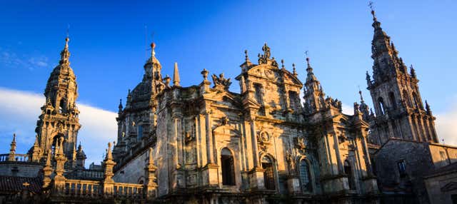
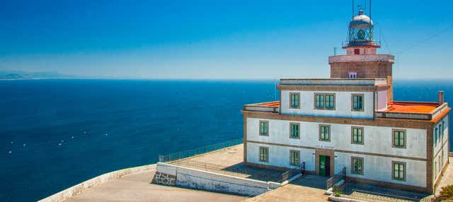
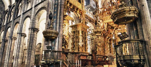
The English Way reaches the cathedral by its north front, on Rúa da Acibechería. A free walking tour, the guided visit of the cathedral and a day trip to Finisterre for the day after you arrive. They are city visits and an excursion, not a Camino package: the walk itself is not included.
The route
The Camino Inglés, the English Way, is the route of the pilgrims who came by sea. In the Middle Ages ships from England, Scotland, Ireland, Flanders and the Nordic countries put in at Ferrol or A Coruña, and their passengers walked the rest. Today there are two itineraries: 112.5 km from Ferrol in five stages, and 73 km from A Coruña. They meet shortly before Bruma and share the last 40 km into Santiago de Compostela.
From Ferrol the route starts at the Curuxeiras docks, where the medieval harbour stood, and spends two days going round the rías through Neda, Fene, Cabanas, Pontedeume and Miño. The towns of those two days, from Ferrol to Miño, all lie between 10 and 32 m. The first stage is graded low and the second medium.
The third stage defines the walk. Miño to Bruma is 34.7 km, graded high and timed at 8 h 20. It crosses the river Mandeo into Betanzos, one of the seven provincial capitals of the old Kingdom of Galicia, at 30 m, and ends at Bruma, at 477 m the highest point on the route. Bruma has a public albergue and the remains of a medieval pilgrim hospital.
After Bruma the route loses height. Bruma to Sigüeiro is 24.2 km, alternating earth tracks and asphalt through woodland to the bridge over the river Tambre, at 155 m. The last stage, 16.1 km, crosses a business park on the edge of Santiago and enters the old town by Rúa da Acibechería, in front of the north façade of the cathedral.
The Ferrol start is the one that qualifies for the Compostela on its own: the certificate requires at least 100 continuous kilometres on a recognised route. A Coruña, at 73 km, falls short of that, and the rule for such cases is specific: walkers who have already begun on foot outside Spain, along a recognised route, need no fewer than 70 km in Spain.
Five days is what the official stage list implies. Four is possible by walking Ferrol to Miño in one day, 37.5 km. Six comes from splitting the long third stage at Betanzos, 10.7 km from Miño and about 24 km from Bruma.
Sample stages
A representative breakdown, not a prescription — most walkers adjust daily distances to their pace, rest days and the weather.
- Day 1 Ferrol → Neda 15.4 km
- Day 2 Neda → Miño 22.1 km
- Day 3 Miño → Bruma 34.7 km
- Day 4 Bruma → Sigüeiro 24.2 km
- Day 5 Sigüeiro → Santiago de Compostela 16.1 km
- Sample total 112.5 km
Practical notes
The things that change how a walk actually goes.
Miño to Bruma is the only stage graded high, and it is timed at 8 h 20. The way out is on the route itself: Miño to Betanzos is 10.7 km and Betanzos has a public albergue with 37 beds, so the stage can be split there into a short day and one of about 24 km.
There are public albergues at Ferrol (60 beds), Neda (26), Miño (21), Betanzos (37), Bruma (19) and Poulo (44), plus Sergude (29) on the A Coruña branch. Bruma, at the end of the hardest stage, is the smallest. Doors open at 1 pm and a stay is one night.
Between A Calle and Sigüeiro the ground around O Carballo and A Casanova is usually waterlogged in winter because of the many springs. When it is, leave the path through the side fields as far as the road by the bridge of A Pereira.
Neda, at the end of the first stage, is 97.1 km from Santiago. Anyone who skips the first stage therefore walks less than the 100 km required for the Compostela.
Drink at least two litres a day and avoid streams, springs and fountains whose water is not known to be drinkable. Fill up where you sleep before the long third stage.
Getting there & back
Ferrol has a railway station, on Avenida de Compostela, and Renfe links the Galician cities with one another. Galicia has three airports, at A Coruña (Alvedro), Santiago (Lavacolla) and Vigo (Peinador); the A Coruña itinerary passes through Alvedro itself. From Ferrol the walk starts at the Curuxeiras docks; in A Coruña it starts at the Romanesque church of Santiago, in the old town.
The route ends at the cathedral of Santiago de Compostela. Walkers without a bed for the last night can leave a bag at the left-luggage office Correos keeps in its branch on Rúa do Franco, a couple of minutes on foot from the Praza do Obradoiro.
Luggage transfer on this route
Correos runs its Paq Mochila on the Camino Inglés from Ferrol between Easter and 31 October, every day, with a 15 kg limit per bag, collection before 8 am and delivery before 2.30 pm. The A Coruña start is not among the routes served, and from 1 November the service stops on this route altogether.
Luggage transfer on long-distance trailsBefore you use public Wi-Fi on the way
Wi-Fi in hostels, cafés and stations is a network shared with other people. A VPN encrypts the connection between your device and the VPN server, one extra layer when you check email or log in to accounts on the move. NordVPN is one option.
See NordVPNOfficial sources & maps
Go straight to the primary sources. We link out rather than re-publish, because these are the pages that stay current.
External links open in a new tab. We don’t control their content.
Frequently asked
How long is the Camino Inglés?
112.5 km from Ferrol to Santiago de Compostela, in five stages of 15.4, 22.1, 34.7, 24.2 and 16.1 km. The alternative from A Coruña is 73 km and joins the Ferrol route shortly before Bruma, about 40 km from Santiago.
How many days do I need?
Five, following the official stages. Six if you break the 34.7 km stage at Betanzos. Four is possible only by joining the first two stages into a 37.5 km day.
Does the Camino Inglés give the Compostela?
From Ferrol, yes: it is 112.5 km, above the 100 continuous kilometres required. From A Coruña it is 73 km, which qualifies only for those who began the pilgrimage on foot outside Spain, on a recognised route, and then walk at least 70 km in Spain.
Ferrol or A Coruña?
Ferrol gives the full route, the rías of the first two days and the Compostela without conditions. A Coruña is shorter, 73 km, reaches 477 m at Bruma in a first stage of 32.8 km, and has a single public albergue before Bruma, at Sergude.
What is the hardest part?
The third stage. Miño to Bruma is 34.7 km and gains most of the route’s height: Betanzos is at 30 m and Bruma at 477 m, with about 24 km between them.
Why is it called the English Way?
Because of who used it. From the twelfth century pilgrims from England, Scotland, Ireland, Flanders and the Nordic countries sailed to Ferrol or A Coruña and walked from the port. The English pilgrimage ended with Henry VIII’s break with the Catholic Church.
Pick a trail.
No sign-up, no sales call. Just the data, the sources and the links you need to plan a long walk properly.