Northern England · Wallsend, Newcastle to Bowness-on-Solway
Hadrian’s Wall Path
A Roman frontier walked end to end, coast to coast across England
At a glance
- Distance
- 135 km
- Duration
- 6–8 days
- Elevation gain
- 2,000 m
- Highest point
- 345 m
- Difficulty
- Easy
- Countries
- United Kingdom
- Best season
- May to October, with the driest ground and the longest days from late May to early September.
- Waymarking
- Excellent
- Water points
- Frequent
- Luggage transfer
- Widely available
- Accommodation
- Guesthouses & B&Bs, Hotels, Campsites
- Permits & bookings
- Not required
The route
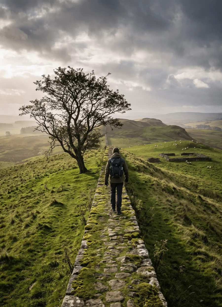
Hadrian’s Wall Path follows the line of the Roman frontier for 135 km across the narrow neck of northern England, from Wallsend on the Tyne in Newcastle to Bowness-on-Solway on the Cumbrian coast. It is a National Trail and a UNESCO World Heritage Site, and it is as much an archaeological walk as a landscape one. The Wall appears in instalments: almost nothing on the first day out of the city, then earthworks, then long stretches of standing masonry riding the crags of Northumberland, then bank and ditch again as the land flattens towards the Solway Firth.
The route is graded easy, with roughly 2,000 m of ascent spread over a week and a highest point of 345 m at Winshields Crags. Nearly all of it is grass, farm track, riverside path or quiet lane. The central section between Chollerford and Walton is the exception: the path rides the Whin Sill escarpment in a repeated sequence of short, steep dips and climbs that walkers consistently underestimate. Grass over rock turns slippery in the wet, and the long spells of pasture mean gates, stiles and livestock rather than mountain hazards.
Seven days is the standard itinerary, averaging about 19 km. Six is comfortable for regular walkers, and eight suits anyone who wants time in the museums. A representative breakdown runs Wallsend to Heddon-on-the-Wall at 24 km, Heddon to Chollerford at 25 km, Chollerford to Steel Rigg at 18 km, Steel Rigg to Walton at 26 km, and Carlisle to Bowness-on-Solway at 24 km. The first day is urban and flat, so it is often walked long. The crags day looks short on paper and is slow in practice.
The path is open all year, but the recommended walking season is May to October. This is farmland and archaeology on thin turf, and the trail authority actively asks walkers to avoid the wettest months because footfall on soft ground damages buried remains. Late May to early September gives the driest going, the longest days and open museums. Crowds concentrate around Housesteads, Sycamore Gap and Steel Rigg, where day visitors arrive by car. Walk that section early or late and it empties out. Winter walking is legal but muddy, and many guesthouses close.
Beds are in villages and small towns strung along the corridor: Heddon-on-the-Wall, Chollerford, Once Brewed and Twice Brewed, Gilsland, Walton, Carlisle, Burgh by Sands. Options are B&Bs, pubs with rooms, hostels, a few hotels and campsites. Supply is thinner through the central crags than anywhere else, which is where you should book first. Many places offer a pick-up and drop-off from a nearby point on the path, worth asking about because it quietly changes which stage breaks are possible. High season fills weeks rather than months ahead.
This is one of the more accessible long walks in Europe. Trains at both ends, a bus running the corridor in season, no navigation difficulty, food most days and gentle gradients make it a sound choice for a first week-long walk, or for walkers who want history rather than altitude. It suits less well anyone looking for wilderness or solitude, since you are rarely far from a road and the middle section is busy, or anyone expecting continuous Wall, because for long stretches the monument is a grassy bank rather than stone.
Sample stages
A representative breakdown, not a prescription — most walkers adjust daily distances to their pace, rest days and the weather.
- Day 1 Wallsend → Heddon-on-the-Wall 24 km
- Day 2 Heddon-on-the-Wall → Chollerford 25 km
- Day 3 Chollerford → Steel Rigg 18 km
- Day 4 Steel Rigg → Walton 26 km
- Day 5 Carlisle → Bowness-on-Solway 24 km
- Sample total 117 km
Practical notes
The things that change how a walk actually goes.
Most of the route is grass, farm track and lane, but the central Whin Sill section is a ladder of short steep climbs on turf over rock. It is slippery when wet and slower than the distance suggests. Poles help; trail shoes are usually enough.
The trail authority asks walkers to keep off the softest ground because footfall damages buried archaeology. Sticking to May to October, using the surfaced or signed line where offered, and never walking on top of the Wall are practical requests rather than formalities.
Villages, pubs and cafés appear most days, so you rarely need to carry much water. The gap to plan for is the crags between Chollerford and Gilsland, where services are sparse and seasonal. Fill up and carry lunch for that stage.
No permit or fee is needed to walk the path. There is a voluntary passport scheme with stamping stations along the route in the summer months, and separate admission charges apply at Housesteads, Vindolanda, Chesters and the other visitor sites.
Expect cattle and sheep on the path, with the usual care around dogs and cows with calves. Near Bowness-on-Solway a short section of the road route beside the estuary can flood on very high tides; the signed alternative avoids it.

Getting there & back
Newcastle International Airport connects to the city centre by Metro in about 25 minutes, and Newcastle Central station is roughly three hours from London by train. From the city, the Metro runs out to Wallsend, close to the official start at Segedunum Roman Fort. Many walkers begin instead from the quayside in the centre and walk the extra riverside kilometres, which makes the first day longer but simpler to reach. Leeds and Edinburgh both work as alternative arrival airports.
Bowness-on-Solway is a small village with no railway. A local bus runs to Carlisle, about 25 km away, where the West Coast Main Line gives fast trains to London, Glasgow and Manchester, and the Tyne Valley line takes you back across the country in around 90 minutes. Buses are infrequent and thin on Sundays, so check the last departure before committing to an evening train. Taxis from Carlisle need booking ahead in high season.
Luggage transfer on this route
Bag transfer is well established here. Operators cover the whole corridor daily through the walking season, and because a road runs close to the path for almost its entire length there are no stages where a bag cannot follow you. Most accommodation is used to handling collections and drop-offs, including the places that also offer a lift to and from the trail.
Luggage transfer on long-distance trailsOfficial sources & maps
Go straight to the primary sources. We link out rather than re-publish, because these are the pages that stay current.
External links open in a new tab. We don’t control their content.
Frequently asked
How many days does Hadrian’s Wall Path take?
Seven days is the standard, averaging around 19 km over the 135 km. Six is comfortable for experienced walkers, and eight leaves time for Vindolanda and Housesteads without rushing. If you only have a long weekend, the central section from Chollerford to Walton holds most of the standing Wall and the best walking.
Which direction is better, east to west or west to east?
East to west, Wallsend to Bowness-on-Solway, is the usual choice: the prevailing wind is behind you, the industrial start gives way to the crags, and the passport scheme is numbered that way. West to east has the advantage of finishing in a city with easy transport, and of saving the best scenery for the middle days.
Is Hadrian’s Wall Path suitable for beginners?
Yes, more so than most week-long routes. It is waymarked with the National Trail acorn, has no navigation difficulty, offers food and beds most days, and its 2,000 m of ascent is spread thinly. The one section that catches people out is the crags, where repeated short climbs tire the legs even though the total height gained is modest.
When is the best time to walk it?
May to October, and ideally late May to early September. That window gives the driest ground, the longest days, open museums and a seasonal bus along the corridor. Winter walking is possible but the ground is soft, the archaeology is easily damaged, daylight is short and many guesthouses shut. Spring and early autumn are the quietest of the recommended months.
Do I see the Wall the whole way?
No, and it is worth knowing before you start. The first day out of Newcastle follows the Tyne with almost no visible remains, and the western third is largely earthwork and ditch. Continuous standing masonry belongs to the central crags between Chollerford and Gilsland, which is why that section is by far the most walked.
Do I need to book accommodation in advance?
In high season, yes. The corridor holds a limited number of beds and the central section between Chollerford and Gilsland is the tight spot, so book that first and work outwards. Several weeks ahead is usually enough for summer. Many places will collect you from a point on the path if the distances do not line up.
Pick a trail.
No sign-up, no sales call. Just the data, the sources and the links you need to plan a long walk properly.