The Dolomites · Alto Adige to Belluno
Alta Via 1
The classic Dolomite high route, hut to hut for 120 km
At a glance
- Distance
- 120 km
- Duration
- 9–12 days
- Elevation gain
- 6,500 m
- Highest point
- 2,752 m
- Difficulty
- Challenging
- Countries
- Italy
- Best season
- Late June to late September
- Waymarking
- Good
- Water points
- Moderate
- Luggage transfer
- Limited
- Accommodation
- Refuges, Mountain huts
- Permits & bookings
- Not required
Before or after the walk
Tours and visits in Venice
A few well-rated options near Alta Via 1, for the rest days either side of the trail. Prices are the provider’s current starting price.
 St. Mark's Basilica + Doge's Palace Tour & Ticketsfrom €108See details ↗
 Rialto & Jewish Quarter Tourfrom €18See details ↗
 Vivaldi's Four Seasons Concertfrom €34See details ↗
 Murano & Burano Day Trip + Glass-Blowing Showfrom €31.90See details ↗
Affiliate links: if you book through them we may earn a commission, at no extra cost to you. It never changes our stage, distance or luggage information. (Civitatis) How the project is funded
The route
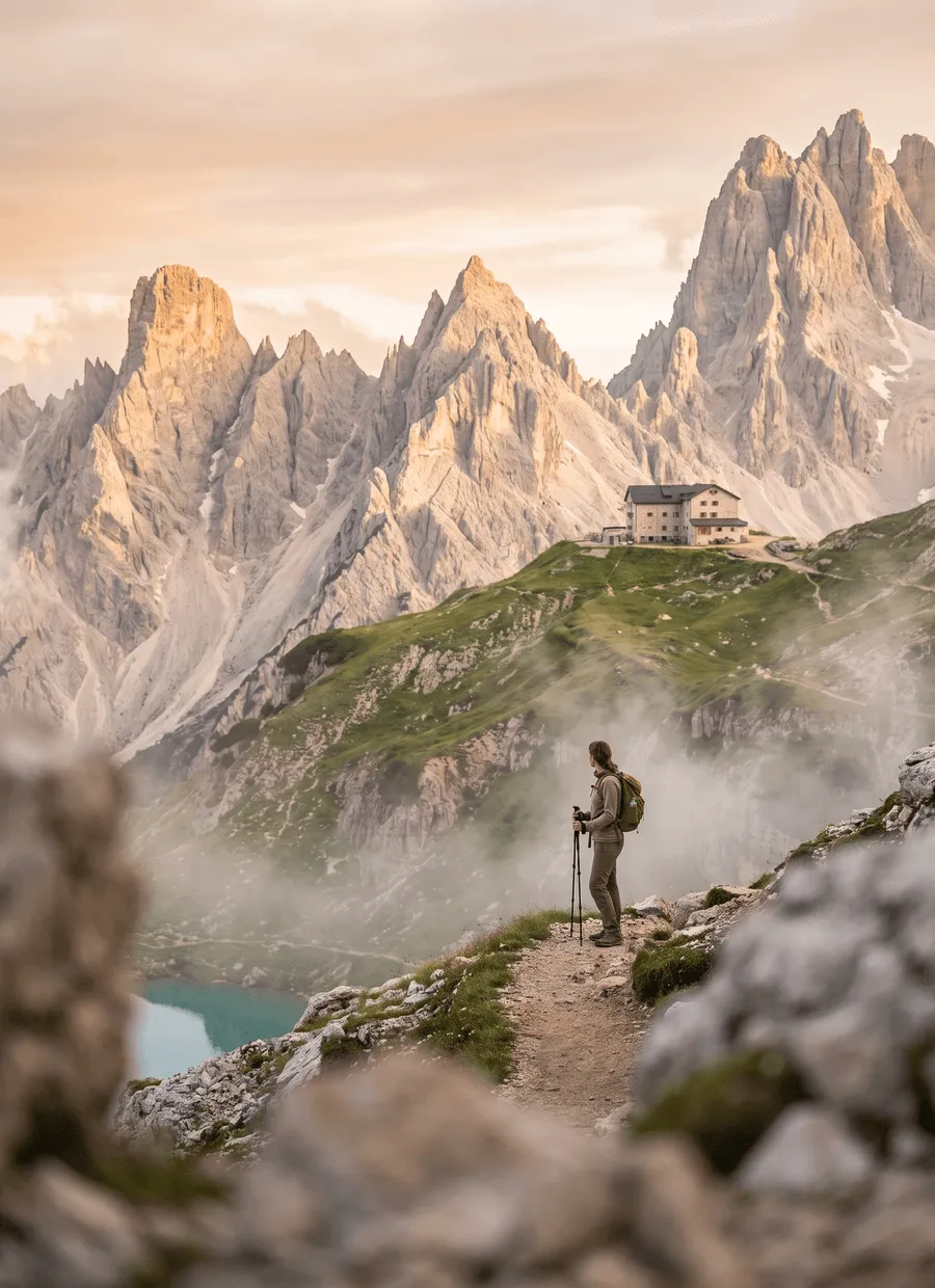
Alta Via 1 is the best known of the Dolomite high routes, running 120 km north to south from Lago di Braies in Alto Adige to Belluno in the Veneto. It threads the Fanes plateau, the war-scarred ridge at Lagazuoi, the Cinque Torri and Nuvolau, the immense west wall of the Civetta, and finally the Schiara group above Belluno. Almost all of it is above the tree line, inside the UNESCO Dolomites, and the whole route is walked hut to hut with no towns in between.
Ascent, altitude and rock define the walking. About 6,500 m of climbing over 120 km sounds moderate until you meet the ground: limestone slabs, scree traverses, and paths built onto ledges that feel exposed even when they are secure. The highest point is Rifugio Lagazuoi at 2,752 m, reached by a stiff climb or by cable car from Passo Falzarego. Some descents, notably below Nuvolau and on the approach to the Schiara, use cabled sections where a hand on the wire is normal.
Eleven days is the standard figure and nine is a hard version. The daily distances look tiny and mislead badly: Lago di Braies to Rifugio Biella is 7 km but climbs about 1,000 m, Rifugio Coldai to Rifugio Tissi is 6 km, and Rifugio Biella to Rifugio Fanes 13 km, Fanes to Lagazuoi 14 km and Lagazuoi to Nuvolau 12 km are all full days. Judge stages by hours and ascent, not kilometres, and expect five to seven hours of walking most days.
The season is set by the huts: roughly late June to late September, with most rifugi opening around the third week of June and closing in the second half of September. Snow sits in north-facing couloirs into early July and can make one or two descents awkward. The Ferragosto period in mid-August is the busiest of the year. Lago di Braies is also a day-trip honeypot, and access to the lake by car is restricted in peak season, so check the current rules before planning a drive.
Accommodation is rifugi and mountain huts, nothing else. Half board is the norm: a bunk or dormitory place, dinner and breakfast, with drinks and packed lunches extra. Reservations are effectively compulsory, and the popular huts around Lagazuoi, Nuvolau, Coldai and Tissi take bookings from spring and fill fast for August. Alpine club membership, including reciprocal arrangements with CAI and the Alpenverein, reduces the overnight rate. Card payment is now common but some huts still prefer cash.
The route suits walkers who are steady on rock, unbothered by exposure and content in dormitories with a shared washroom. Distances are short and the reward per hour is high. Raw fitness counts for less here than sure footing on loose ground, since several stages are under 10 km. It suits less well anyone hoping for villages, restaurants and bag transfer each evening, walkers who dislike heights, or those who need certainty about beds, since the whole trip depends on reservations made months earlier.
Sample stages
A representative breakdown, not a prescription — most walkers adjust daily distances to their pace, rest days and the weather.
- Day 1 Lago di Braies → Rifugio Biella 7 km
- Day 2 Rifugio Biella → Rifugio Fanes 13 km
- Day 3 Rifugio Fanes → Rifugio Lagazuoi 14 km
- Day 4 Rifugio Lagazuoi → Rifugio Nuvolau 12 km
- Day 5 Rifugio Coldai → Rifugio Tissi 6 km
- Sample total 52 km
Practical notes
The things that change how a walk actually goes.
Underfoot is limestone: slabs, loose scree and rebuilt ledge paths. Boots with ankle support and a stiff sole work better than trail shoes here, and poles help on the long scree descents from Lagazuoi and towards the Vallon delle Ziolere.
Natural springs are sparse on limestone and streams disappear underground, which is why availability is rated moderate. Fill two litres at each rifugio, expect to pay for bottled or filtered water at some of them, and plan hot days around hut positions.
There is no fallback accommodation between huts and wild camping is not permitted in the park. Book the full chain of rifugi as soon as reservations open in spring, confirm by email a few days ahead, and carry enough cash for huts that dislike cards.
Mid-August is the peak of Italian holidays, when huts are full and the Braies trailhead is thick with day visitors. Access to the lake by private car is restricted in high season, so plan the first morning around the shuttle bus instead.
The last stages through the Schiara are the most serious, with cabled ground including the Ferrata del Màrmol. Walkers without via ferrata experience or kit routinely finish at La Pissa on the valley road and take the bus into Belluno instead.
Getting there & back
Venice is the usual gateway, with Verona, Treviso and Innsbruck as alternatives. From Venice, trains run to Fortezza or Dobbiaco via the Val Pusteria line; from Villabassa or Dobbiaco, local buses reach Lago di Braies in around half an hour in summer. Munich and Innsbruck connect southbound over the Brenner to the same valley. Most walkers arrive the day before and sleep at the lake or in Dobbiaco to start walking early.
The route ends in Belluno, which has a railway station with services to Conegliano and on to Venice in about two hours, plus buses down the Piave valley. If you finish at La Pissa rather than walking the Schiara ferrata, a local bus covers the last stretch into Belluno. Cortina d’Ampezzo, roughly midway, is a useful exit point with coach links to Venice airport for anyone shortening the trip.
Luggage transfer on this route
Bag transfer is limited, and for a simple reason: almost none of the rifugi on Alta Via 1 has road access, so no van can reach them. Plan to carry everything, typically 8 to 10 kg, and use a courier or left-luggage service to move a suitcase from the Braies area to Belluno. Huts supply blankets and pillows, so a lightweight liner replaces a sleeping bag.
Luggage transfer on long-distance trailsOfficial sources & maps
Go straight to the primary sources. We link out rather than re-publish, because these are the pages that stay current.
External links open in a new tab. We don’t control their content.
Frequently asked
Is Alta Via 1 harder than the Tour du Mont Blanc?
It is shorter and climbs less overall, but the ground is rockier and more exposed, and there are no villages to retreat to. The TMB has bigger daily ascents; AV1 has more scree, more airy path and total dependence on huts. Most walkers find AV1 mentally harder and physically slightly easier.
Do I need via ferrata equipment?
Not for the main route, where cabled sections are short and can be walked with hands on the wire. Equipment matters for the optional Schiara finish, which includes the Ferrata del Màrmol, and for side trips such as the Lagazuoi tunnels. Walkers without it commonly end the route at La Pissa.
How do I book the rifugi?
Directly with each hut, usually by email or an online form, from spring onwards for the summer season. Book the full sequence at once so your stages line up, since a single unavailable night can force a very long day. Reconfirm shortly before arrival and tell them about dietary needs then.
How many days does Alta Via 1 take?
Eleven days is typical, nine is possible for fast walkers combining stages, and twelve gives a rest or weather day. Daily distances of 6 to 14 km look easy but include 600 to 1,000 m of ascent on rocky ground, so plan by walking hours rather than kilometres.
When is the best time to walk it?
Late June to late September, matching the hut season. Early July can still hold snow in shaded couloirs. Mid-August is hot, clear and extremely busy. Early September is arguably the best compromise, with stable weather and thinner crowds, though huts start closing in the second half of the month.
Can I walk only part of the route?
Yes. The section from Lago di Braies to Cortina d’Ampezzo, taking about five days, covers the Fanes plateau and Lagazuoi and has good bus links at both ends. The southern half from Cortina to Belluno gives the Civetta and Schiara. Passo Giau and Passo Falzarego are other useful entry and exit points.
Pick a trail.
No sign-up, no sales call. Just the data, the sources and the links you need to plan a long walk properly.