Alentejo & Algarve · Porto Covo to Lagos
Rota Vicentina
Clifftop paths and Atlantic sand down Portugal’s wildest coast
At a glance
- Distance
- 230 km
- Duration
- 10–13 days
- Elevation gain
- 2,500 m
- Highest point
- 150 m
- Difficulty
- Moderate
- Countries
- Portugal
- Best season
- March to October, with April and May or September and October the most comfortable months.
- Waymarking
- Excellent
- Water points
- Moderate
- Luggage transfer
- Widely available
- Accommodation
- Guesthouses & B&Bs, Hotels, Campsites
- Permits & bookings
- Not required
Before or after the walk
Tours and visits in Lagos
A few well-rated options near Rota Vicentina, for the rest days either side of the trail. Prices are the provider’s current starting price.
 Ponta da Piedade Caves Kayak Tourfrom €35See details ↗
 Sagres Coast Sunset Jeep Tourfrom €63See details ↗
Affiliate links: if you book through them we may earn a commission, at no extra cost to you. It never changes our stage, distance or luggage information. (Civitatis) How the project is funded
The route
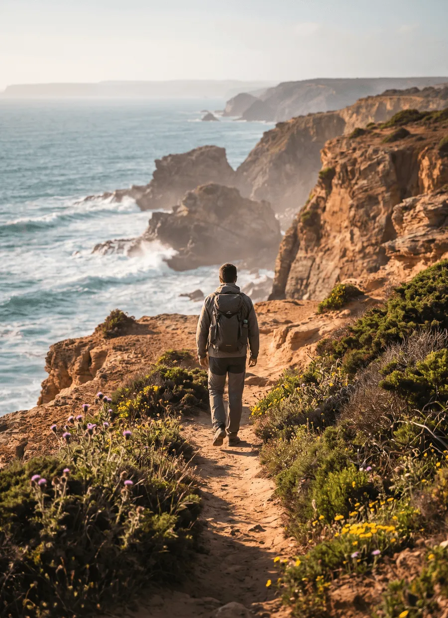
The Rota Vicentina is a waymarked network on the south-west coast of Portugal, inside the Southwest Alentejo and Vicentine Coast Natural Park. Its coastal strand, the Fishermen’s Trail, runs about 230 km from Porto Covo in the Alentejo down to Lagos in the Algarve, following the clifftop tracks that fishermen use to reach their fishing ledges. The inland Historical Way runs roughly parallel through cork oak and eucalyptus. Most walkers take the Fishermen’s Trail, or a hybrid: coast where the coast is good, inland when the wind or the sand becomes tiresome.
The numbers understate the effort. Total ascent is only about 2,500 m and the highest point around 150 m, but a large share of the walking is on loose sand — dune paths, beach and soft cliff track — which is slow and works the calves in a way flat ground does not. Expect roughly a third more time than the distance suggests. Cliff edges are unfenced and undercut in places, and the path runs close to them. In the afternoon the north-westerly picks up and drives sand and salt straight into your face if you are walking north.
Twelve days is the typical figure for the full 230 km, averaging under 20 km a day. Six days covers the classic original section from Porto Covo to Odeceixe, which is what many people actually walk. Sample stages run Porto Covo to Vila Nova de Milfontes at 20 km, Milfontes to Almograve at 15 km, Almograve to Zambujeira do Mar at 22 km, Odeceixe to Aljezur at 18 km, and Carrapateira to Vila do Bispo at 20 km. Villages are conveniently spaced, so the route breaks naturally and shortening a day is usually possible.
March to October is the walking season, and the shoulder months are clearly the better half of it. April and May bring wildflowers on the cliffs, moderate temperatures and reliable light. September and October are warm, calmer and quiet, with the sea at its warmest. July and August are hot, fully exposed and busy with Portuguese and Spanish holidaymakers, and the villages fill up. Winter is mild and walkable but wetter and windier, with some guesthouses and restaurants closed. Atlantic fog is common on early summer mornings and usually burns off by mid-morning.
You sleep in village guesthouses, small hotels, hostels and campsites in places such as Vila Nova de Milfontes, Zambujeira do Mar, Odeceixe, Aljezur, Carrapateira and Sagres. Supply is decent by long-trail standards, but these are small seaside villages that also serve summer holidaymakers, so August is genuinely tight and Easter weekends fill early. The trail association publishes a list of accommodation that has signed up to serve walkers, including places that will collect you from the path. A month or two ahead is usually enough outside high summer.
The Fishermen’s Trail suits walkers who want a coast rather than a mountain: no altitude, no navigation problem, a café most days, and swimming at the end of many stages. It is a good early-season or late-season option when Alpine routes are shut. It suits less well anyone who dislikes sand, wind or heat exposure, since there is almost no shade for hours at a time, and anyone who needs firm, predictable footing, because the cliff paths are uneven and the drops beside them are unprotected.
Sample stages
A representative breakdown, not a prescription — most walkers adjust daily distances to their pace, rest days and the weather.
- Day 1 Porto Covo → Vila Nova de Milfontes 20 km
- Day 2 Vila Nova de Milfontes → Almograve 15 km
- Day 3 Almograve → Zambujeira do Mar 22 km
- Day 4 Odeceixe → Aljezur 18 km
- Day 5 Carrapateira → Vila do Bispo 20 km
- Sample total 95 km
Practical notes
The things that change how a walk actually goes.
A large part of the Fishermen’s Trail is loose sand on dune paths and beaches. It is tiring and roughly a third slower than firm ground, so plan shorter days than the kilometres suggest. Gaiters help, as do shoes you can empty easily.
The cliffs are fully exposed and the north-westerly blows hardest in the afternoon, which is an argument for walking north to south. There is virtually no shade between villages, so start early in summer and take sun cover as seriously as you would waterproofs.
Cafés and shops in the coastal villages mean you rarely go a whole day without resupply, but there are no reliable water sources between them and the water you pass is salt or brackish. Carry at least two litres, and three on the hot stages.
The path runs close to unfenced, crumbling cliff edges, and some sections cross beaches where a high tide narrows the walkable strip. Keep back from overhangs, keep children close, and check tide times for the beach sections rather than assuming they are always passable.
No permit or fee is required. The route runs inside a natural park, so camping is restricted to official campsites, fires and drones are controlled, and marked diversions protect nesting birds in spring. Waymarking is green and blue on the coast, red and white inland.

Getting there & back
Lisbon is the usual arrival airport. From the Sete Rios terminal, Rede Expressos coaches run south towards Sines, Cercal and Porto Covo in roughly three hours, sometimes with a change. Some walkers instead take a train to Grândola or a coach to Vila Nova de Milfontes and start there, which cuts a day. There is no railway to the trailhead itself, so a coach or a pre-arranged road transfer is the practical option, and Sunday services are thinner.
Lagos has a station at the end of the Algarve line, with trains to Faro in around 90 minutes and connections north to Lisbon; coaches run direct to both Lisbon and Faro airport. Faro is much the closer airport and often the cheaper flight home. If you finish at Sagres or Vila do Bispo rather than walking the last stages, local buses run to Lagos several times a day, with fewer at weekends.
Luggage transfer on this route
Bag transfer is well established on the Rota Vicentina. Local taxi firms and small operators move bags between villages daily in season, and because a road reaches every overnight stop there are no stages where your bag cannot follow. Most guesthouses will hold or hand over bags, and the trail association lists the services. A day or two of notice is usually enough outside high summer.
Luggage transfer on long-distance trailsOfficial sources & maps
Go straight to the primary sources. We link out rather than re-publish, because these are the pages that stay current.
External links open in a new tab. We don’t control their content.
Frequently asked
How many days do you need for the Fishermen’s Trail?
Twelve days covers the full 230 km from Porto Covo to Lagos at under 20 km a day. The classic six-day version runs Porto Covo to Odeceixe and is what most people walk. Because sand slows you down, plan shorter stages than you would on firm ground and keep a spare day for wind or heat.
Fishermen’s Trail or Historical Way?
The Fishermen’s Trail hugs the cliffs and beaches: better views, more sand, more wind, more exposure. The Historical Way runs inland through cork oak, farmland and villages, firmer underfoot and shadier, and it is the better option in bad weather. Link paths join the two most days, and combining them stage by stage is common and well signed.
Which direction should I walk it?
North to south, Porto Covo towards Lagos, puts the prevailing north-westerly behind you rather than in your face, which matters more here than any gradient. It also builds towards Cape St Vincent. Walking south to north is done, but expect afternoon wind and blown sand head-on for hours at a time.
When is the best time to walk it?
March to October, with April to May and September to October the best of it. Spring gives wildflowers and mild temperatures; autumn gives warm water and quiet villages. July and August are hot, shadeless and busy with holidaymakers, and beds get scarce. Winter is walkable but wet and windy, with some places closed.
Is it suitable for beginners?
Yes, with one caveat. There is no altitude, the waymarking is excellent, and villages come regularly. The caveat is the sand and the exposure: soft ground, sun and wind make a 20 km coastal day feel much longer than a 20 km inland one. Beginners usually do better starting with the six-day Porto Covo to Odeceixe section.
Can I swim along the way?
Most days, and it is one of the pleasures of the route. Many stages pass or finish at a beach, and September and October have the warmest water. The Atlantic here is cold, and currents and shore break can be strong on the open beaches, so prefer the sheltered, patrolled beaches near the villages.
Pick a trail.
No sign-up, no sales call. Just the data, the sources and the links you need to plan a long walk properly.